Seeing beyond the surface
Imagine having the ability to see underground, through walls, and beneath foundations – all without disturbing the surface. That’s the power of geophysics. We don’t just guess what’s hidden beneath; we reveal the unknown such as sinkholes, rock depths, contaminant plumes, fracture zones, underground storage tanks (USTs), or new water sources with precision and expertise.
The days of blind excavation and costly surprises are in the past. Today, we use cutting-edge technology to map what’s invisible, providing our clients with the insights they need to make smart, informed decisions. Need to know about a potential sinkhole? Wondering about underground utilities? Want to understand rock depths for a pipeline? Don’t dig blindly – let us scan the surface and show you exactly what’s beneath your feet.
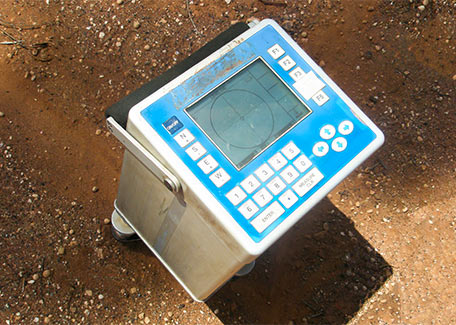
For more than 30 years, our geophysics experts have designed and conducted a wide variety of geophysical surveys. Selecting the correct technique to identify a potential problem is critical. At RETTEW, we take the time to understand your specific project needs and then select the best tools based on the application and site conditions—and since we own all the necessary equipment, we already have the right tools available to match your needs.
Understanding what our clients need is more than a service—it’s our mission. At RETTEW, we are a full-service engineering firm that bridges the gap between challenge and solution, offering expert teams across a multitude of disciplines including geoenvironmental, geotechnology, land planning, subsurface utility engineering, and surveying. Whether you’re an engineer seeking underground insights, an archaeologist uncovering historical landscapes, or an environmental consultant mapping complex terrains, our geophysics team doesn’t just deliver data—we illuminate paths forward, transforming the unknown into clear, actionable intelligence.
Solving earth’s hidden mysteries. One survey at a time.
Geophysics is only limited by your imagination – and that’s where RETTEW comes in. We work in tandem with your team, getting to know your project, asking the right questions, and working with those in the field to develop a solution that gives you the precise information you need – now and in the future. By identifying potential issues before they become problems, we help you save time, reduce costs, and avoid unexpected challenges that could derail your project.
Geophysics in practice
When a new high school began experiencing mysterious wall cracks, our team didn’t just look – we scanned. Using ground-penetrating radar (GPR), we examined the concrete walls revealing critical construction flaws that could have led to a future collapse. By catching these issues early, we prevented potential disasters and upheld a safe learning environment.
As the result of an unfortunate incident, a manufacturing company lost a 1400-lb steel gear that launched through the roof and disappeared underground half a mile away in a nearby field. Traditional probing failed, but our electromagnetic scanning located the gear within a day – 32 feet laterally from its impact crater and 22 feet deep. What seemed impossible became a simple solve.
When a state’s historical commission needed to locate a Civil War surgical hospital and an unmarked French and Indian war cemetery, we used ground-penetrating radar to pinpoint exact locations, turning historical speculation into documented fact.
When a construction project faced potential millions of dollars in unforeseen building expenses, our seismic site classification survey transformed uncertainty into strategic planning. Using advanced geophysical techniques, we mapped the ground’s site-specific seismic strength, which helped our client optimize building design, potentially saving hundreds of thousands of dollars in construction costs and enabling a safer, more resilient structure.
When an industrial facility in Missouri began mysteriously sinking, traditional drilling methods revealed nothing. Our microgravity survey uncovered the shocking truth – a massive, previously undetected 290-foot-high underground cavern buried nearly 100 feet below the ground surface. What began as an alarming structural failure became a testament to the power of geophysical investigation. By revealing the hidden subterranean void, we transformed a potential disaster into a critical learning opportunity about the importance of comprehensive underground mapping.
Geophysics is a critical tool, not a luxury
Geophysics is insight defined. With more than 100 collective years of experience, RETTEW transforms the most complex underground challenges into clear, actionable intelligence. Every hidden layer, every unseen obstacle represents a potential risk – or opportunity – waiting to be understood. Blind excavation and guesswork are relics of the past. Our cutting-edge technology doesn’t just map the unknown; it empowers decision-makers to navigate complex terrains with unprecedented confidence and precision.
Great people; great science.
At RETTEW, we don’t just solve problems – we help prevent them before they can emerge. We believe every project’s success begins beneath the surface. Our geophysical solutions are more than technical services; they’re strategic partnerships that turn uncertainty into a competitive advantage. By combining deep expertise, state-of-the-art technology, and a commitment to understanding each client’s unique challenges, we convert potential geological obstacles into clear pathways for innovation, safety, and efficiency. When others see complexity, we see opportunity.
Read our Beneath the Surface Newsletter
Geophysics Specialties:
- Archaeological Geophysics
- Aerial Magnetometry
- Bedrock Depth/Rippability Mapping
- Borehole and Excavation Utility Clearance – SUE
- Borehole Logging and Imaging
- Contaminant Plume Delineation
- Corehole/Borehole Clearance – SUE
- Corrosion and Grounding Analysis
- Crosshole and Uphole Tomography
- Electrical Imaging
- Expert Witness Research and Testimony
- Fracture/Migration Pathway Mapping
- Karst Hazards and Features Assessment
- Liner Leak Detection
- Mise a la Masse
- Monitoring or Production Well Siting
- Seismic Site Classification and Hazard Analysis
- Seismic Refraction vs. Seismic Reflection
- Underground Utility Mapping – SUE
- UST Mapping
- Void Detection
- Well Siting